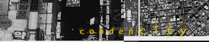
condenCITY_80 Seoul from above 1.2


From above Seoul is mixed

Architecture is at once road, programmed space, bridge, public node, parking lot, to name just a few; collective as a multi-functional device in the city. Bound indistinguishably on its sides, concealed and then revealed. Architecture, by determined will (and absolute limits), as it was constructed in double-time, producing road, market and modern apartment block in one economic effort. Simultaneously they rose, as we see it today from above; the confluence of Nagwon.


condenCITY_79 Seoul from above 1.1


The Seoul Metropolitan area is 605 square kilometers (or 233 sq. miles). It's population of 10,464,051 estimated in 2010, is concentrated in an area of 17,288 people per square kilometer (44,770 per square mile); in comparison New York City's density of approximately (27,500 people per square mile) is clear indication of just how dense Seoul is in terms of population per area. From above at night, in this NASA satellite image, we too are reminded of Seoul's defining topographic boundaries and limits, viewed here in its thinly delicate and fragile form (quite opposite the constructed reality at ground level). The cities overflowing edges have been pushed outward and forced through narrowing geographies, north and south, east and west, visible high in the night sky.


condenCITY_78 1912 Se-ul From Above 1.0


Image courtesy nationmaster.com


Seoul has a history of being fictitious when it comes to mapping and representations of the city on paper. Through centuries either locally or by the hand of visiting foreigners (as viewed in the map above) it has been laid out and mapped according to personal perceptions, a kind of visual feeling, rather than by any exactness of measure or precision. It is a representation that permeates even the city today; in its constructed imprecise form.